Google Earth Layers
Click on the words for the download. Bigger files can take a while depending on the quality of connection and your devices processing power.
1. Forest Types. It's fairly crude but can be useful. (2mb)
2. Fire history. Seems to cover the history of most fire (wild and controlled) from c1930 - 2019 (before Black Summer). Will add that later. (85mb) This layer may not have all fires, I know it missed at least one from the 1960s in an area where I know the history.
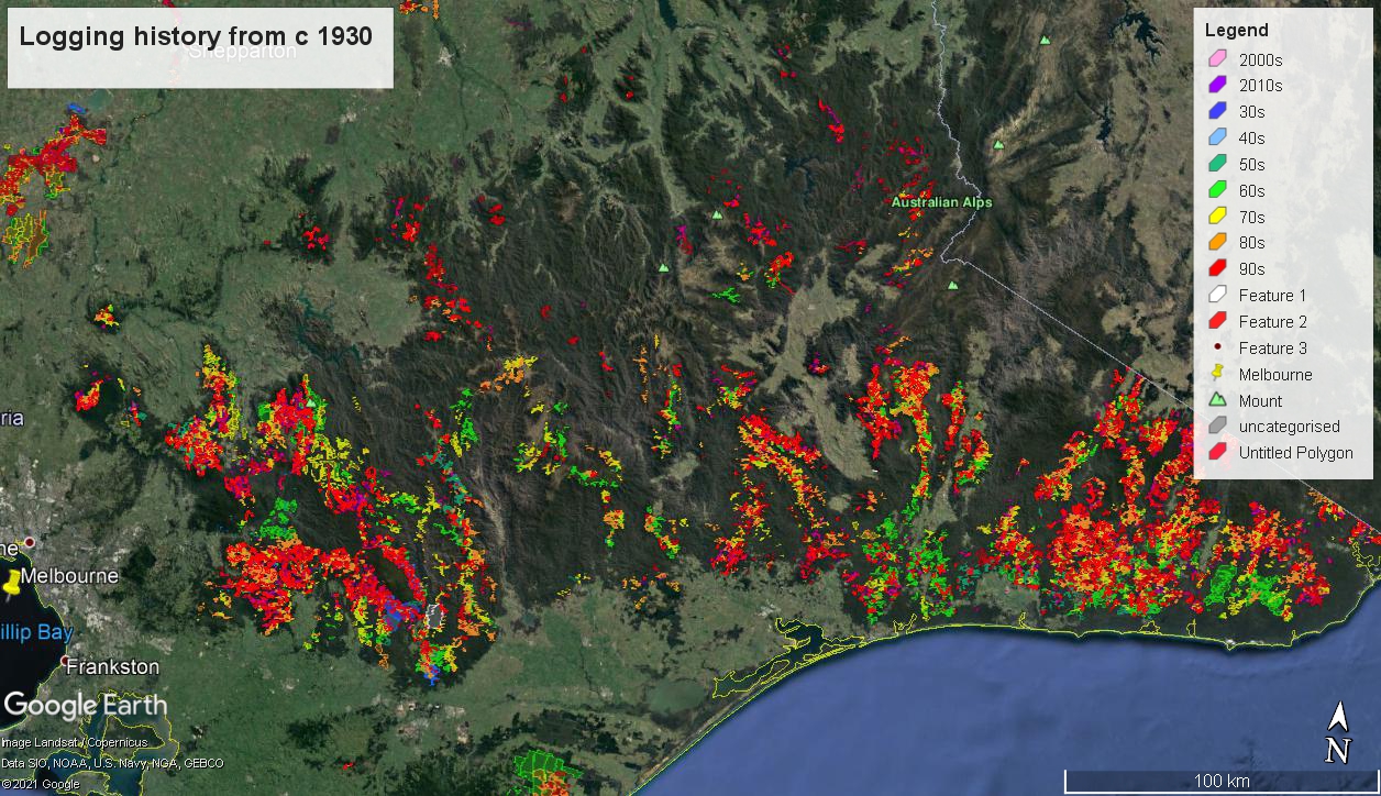
3. Logging history. Fairly extensive record of all logging back to 1930s. (37mb)
4. Clearfell history. (11mb)
5. Current Timber Release Plan for logging coupes scheduled to 2024. (20mb)
6. Mapped old growth. Supposedly government maps of old growth forest in Victoria but the maps don't align with satellite images showing tree canopies. (21mb)
First tip, if you click on the displayed layer at any given point in Google Earth, you'll get a box pop up with information about date, size etc.
Second tip, you can select a layer and change its properties in the sidebar. (click view on the menu on the toolbar at the top > tick sidebar > the layer you clicked on will be highlighted in the sidebar > right click the highlighted object in the sidebar and a menu with properties as an option pops out > e.g. change color and transparency etc, help yourself). If you mess it up, just delete the layer and open it again from your download folder.
The CTRP (number 5) says we'll log 25,000 X the MCG in the next 3 years. For the record, most of that has never been touched or disturbed before.